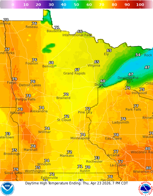
It’ll feel summerlike Thursday as temperatures soar into the 80s across southern Minnesota. A developing system will touch off storms throughout the day and some could be severe.
Severe storms possible Thursday followed by a cooldown
Temperatures will be warm again Thursday. Enjoy those readings because we probably won’t be this warm again for a week or two if forecast models are to be believed. Highs will be back in the 70s with 60s northeast and cooler readings near Lake Superior.
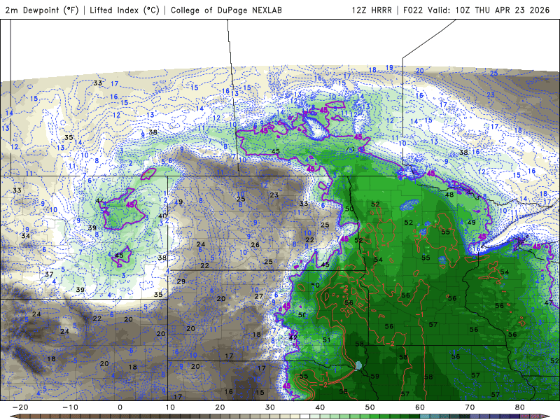
Dew points will be another thing you’ll notice. They have gone up overnight and will continue to do so Thursday ahead of a cold front. We could see dew points Thursday afternoon in southern Minnesota near 60 degrees, which is muggy for April.
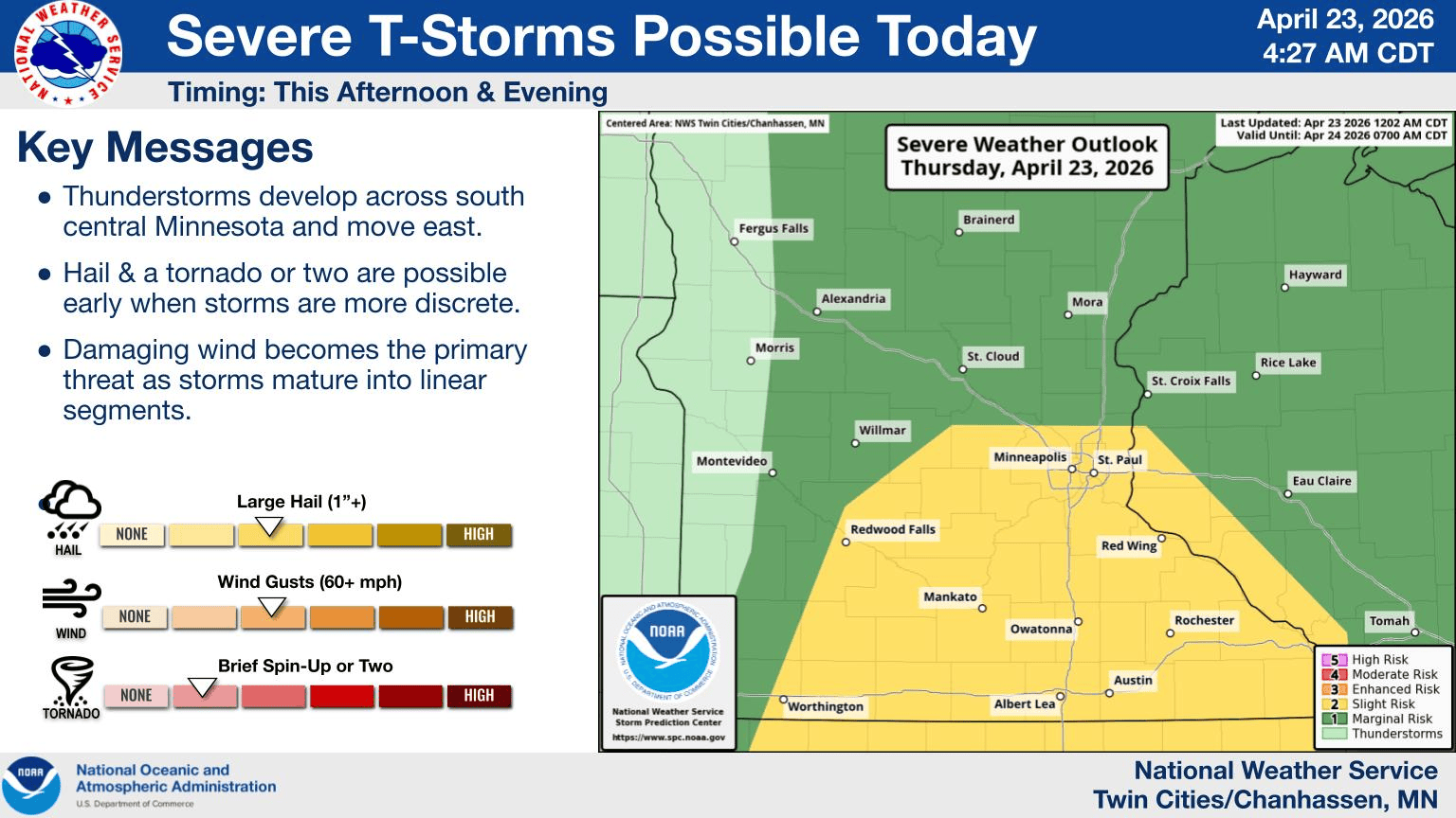
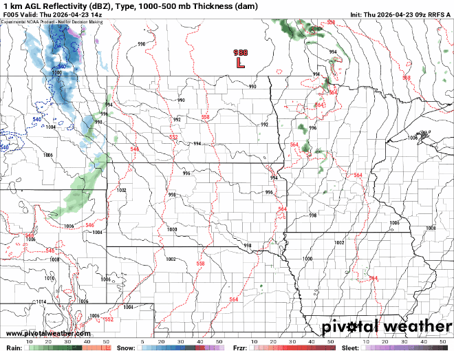
That added moisture and front will be the focus for more potential severe weather later Thursday. This will be our third round of possible severe weather in less than two weeks. That is rather unusual for April.
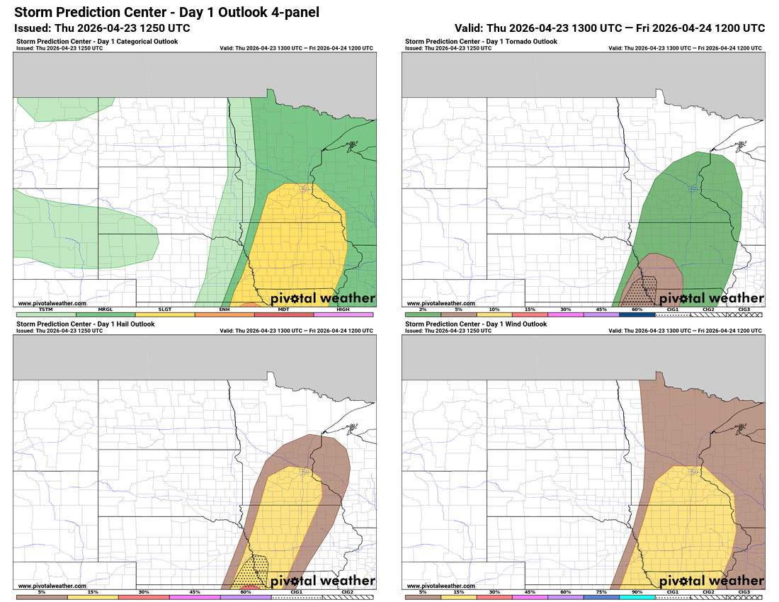
The National Oceanic and Atmospheric Administration’s Storm Prediction Center forecasts a slight risk (level 2 of 5) for severe storms Thursday afternoon and evening for portions of southern Minnesota.
There will likely be some spotty showers ahead of the front already during the day Thursday, but thunderstorms will develop ahead of the front mid to late afternoon into the evening and track east.
Those initial storm cells could produce an isolated tornado or two with the bigger threats being large hail and some damaging wind gusts.
The setup Thursday doesn’t look as impressive as last Friday or Monday, however. The greatest tornado threat is south into Iowa, Nebraska and Kansas.
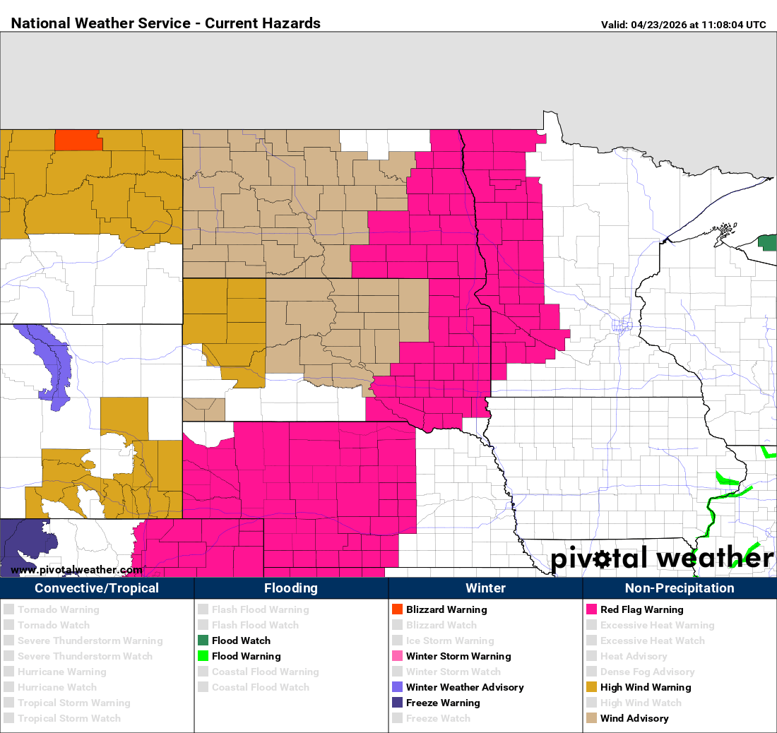
We also have red flag warnings due to critical fire conditions again for western Minnesota Thursday afternoon as drier air moves back in and gusty west winds develop.
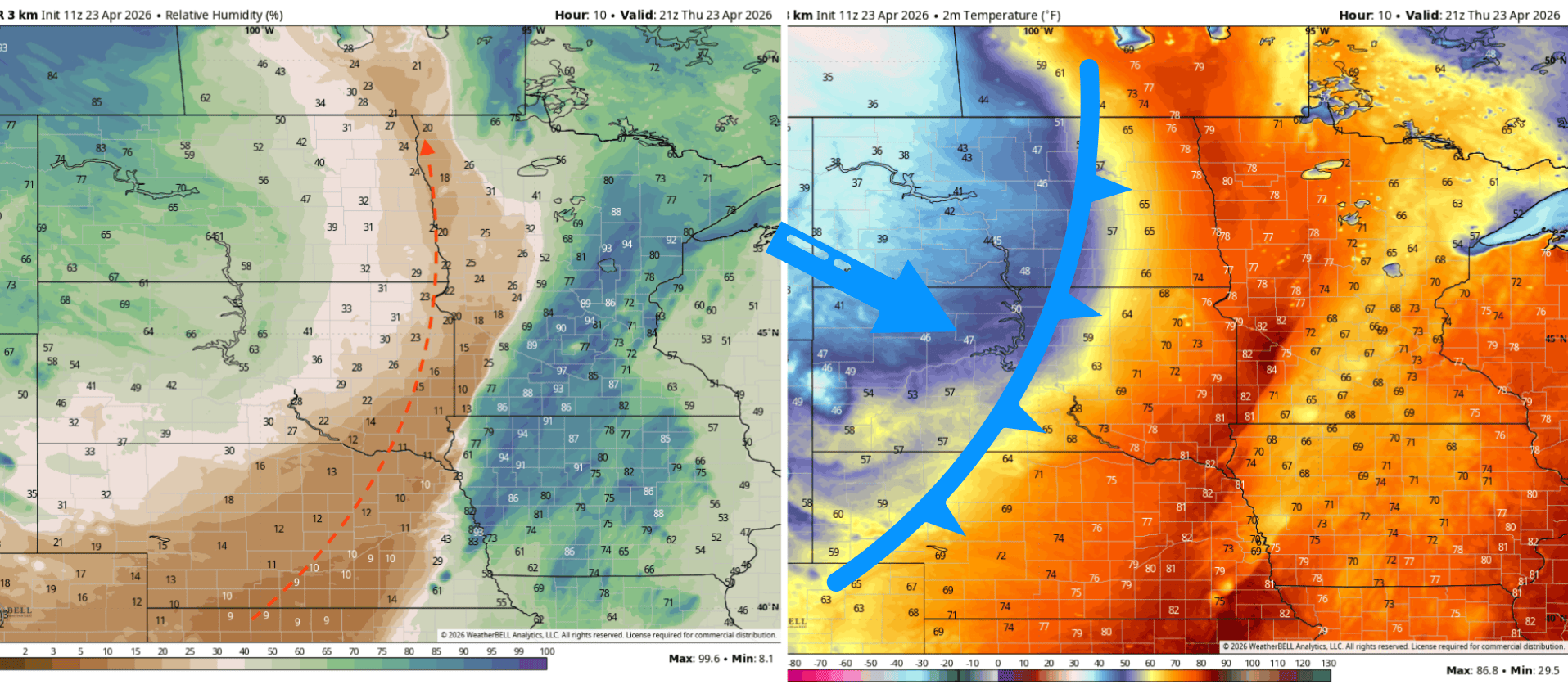
Interestingly, today’s critical fire weather conditions are being driven by a “dry line,” something we don’t see a lot of in Minnesota. You can see a big drop in relative humidity late Thursday afternoon in western Minnesota extending southwest into Nebraska.
The actual cold front is farther behind that into the central Dakotas. This dry air is originating from the high desert areas of New Mexico and Colorado, being pushed northeast ahead of the cold front and behind the surge of higher dew points Thursday.
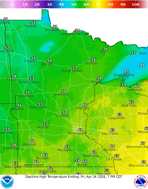
Behind it, temperatures drop to seasonable levels for Friday and the weekend. Highs Friday will be mostly in the 50s and 60s.
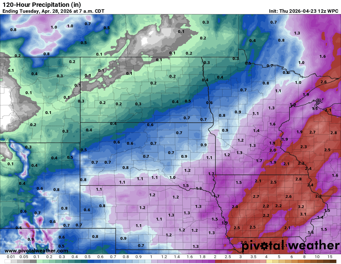
Another storm system looks to bring mostly rain and garden variety thunderstorms late Sunday into Monday.
It could be a decent rainfall for central and southern Minnesota. Total forecast rainfall (including Thursday’s rainfall) through early Tuesday could be in the 1 to 2-inch range for a large area: