Clouds increase Wednesday. Then rain and snow develop later Wednesday into Wednesday night when we’ll see a wintry mix. Wintry precipitation continues into Thursday with another system Friday into Saturday.
2 rounds of wet, wintry weather incoming
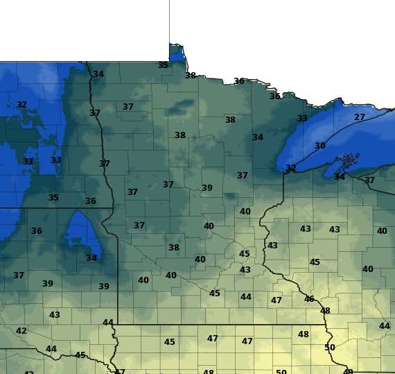
We’ll be dry most of Wednesday with clouds increasing through the day. Afternoon highs will be mostly in the 40s and 30s across Minnesota.
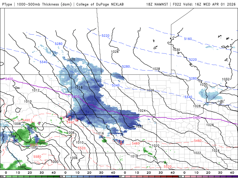
Rain showers will move into southwest Minnesota Wednesday afternoon and expand north and east into the evening. Snow showers will develop in west-central Minnesota and spread across north-central Minnesota into the evening. Overnight snow will be the dominant precipitation type in northern Minnesota with a wintry mix in central Minnesota, including freezing rain with mostly rain south.
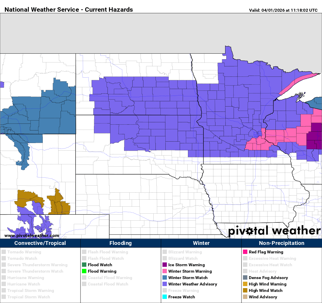
Winter storm warnings and winter weather advisories are posted across Minnesota for Wednesday night into Thursday.
Here’s a snapshot of precipitation and type roughly by timeframe Wednesday night into Thursday evening.
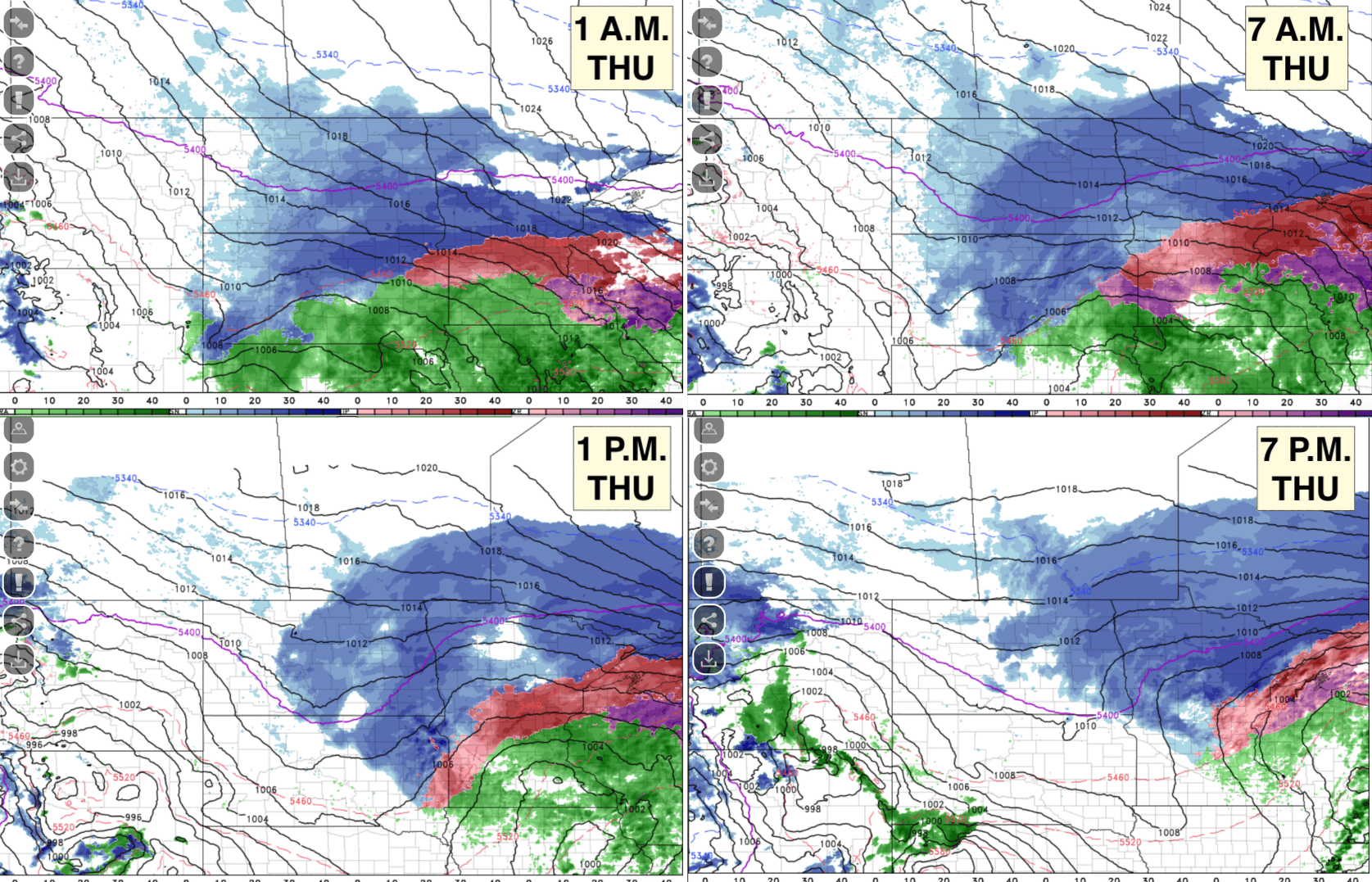
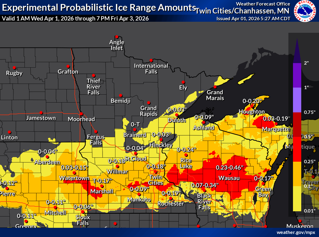
Ice accumulation will be possible late Wednesday night into Thursday morning across portions of central and southeast Minnesota, including the Twin Cities. Many areas could see one-quarter inch or more of ice accumulation in the early morning hours Thursday.
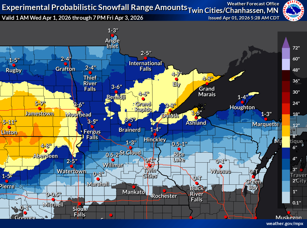
The bulk of the snowfall with this second system of the week will fall across central and northern Minnesota and the North Shore. The Twin Cities will likely see some slushy accumulation, but with precipitation moving back and forth from rain to sleet and freezing rain and snow back to rain, we’ll be rather limited.
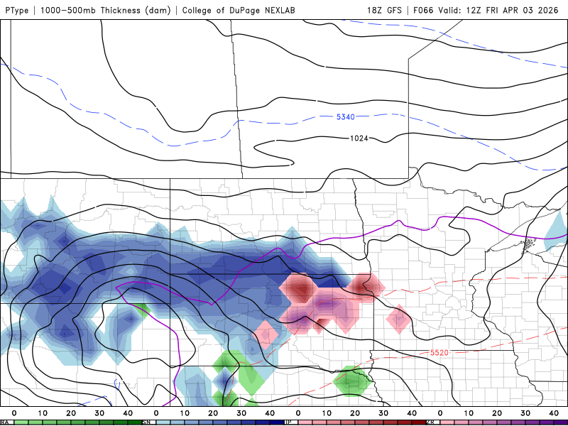
Another system moves in for Friday into Saturday. It will likely bring another round of wintry precipitation with multiple types. The snowfall looks to follow a similar pattern as Wednesday night’s and Thursday’s system.