A powerful cold front spawned a line of severe storms with large hail, damaging winds, and tornadoes Friday.
Several tornado sightings came in from near Rochester across southeast Minnesota.
MnDOT traffic cams captured the smaller rope tornado early in the life cycle.
The tornado grew into a more robust and dangerous tornado as it moved east.
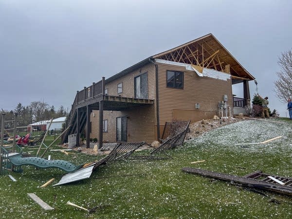
Multiple video clips came in from damaged areas.
The line of storms ran from the North Shore through western Wisconsin into southeast Minnesota Friday. Here are just some of the many storm reports.
-
2 ENE Two Harbors [Lake Co, MN] Public reports Hail of quarter size (M1.00 Inch) at 3:12 PM CDT — Report via social media.
-
4 WSW Castle Danger [Lake Co, MN] Trained Spotter reports Hail of ping pong ball size (M1.50 Inch) at 3:20 PM CDT — Majority of hail was three quarters to one inch in size but some pieces as large as 1.5 inches. Photo sent to NWS Duluth. Time estimated from radar.
-
Hayward [Sawyer Co, WI] Emergency Mngr reports Tstm Wnd Dmg at 3:35 PM CDT — Hayward Laundry on Dakota Ave had its roof torn off by the wind. No injuries reported.
-
8 WNW Minong [Washburn Co, WI] Mesonet reports Tstm Wnd Gst of M68 MPH at 3:28 PM CDT — Mesonet station MRZW3 Minong RAWS. Time of wind gust estimated from radar.
-
NNW Bay City [Pierce Co, WI] Trained Spotter reports Hail of half dollar size (M1.25 Inch) at 2:47 PM CDT — Emailed photos of large hail in backyard. Time estimated via radar.
-
2 SW Minneapolis [Hennepin Co, MN] Public reports Hail of penny size (M0.75 Inch) at 2:18 PM CDT —
-
N Stewartville [Olmsted Co, MN] Public reports Tornado at 2:32 PM CDT — Rochester Tower reported tornado on the ground near Highway 63.
-
1 W Hayfield [Dodge Co, MN] Emergency Mngr reports Hail of golf ball size (M1.75 Inch) at 1:36 PM CDT —
-
2 N Elgin [Wabasha Co, MN] Public reports Tornado at 2:53 PM CDT — Tornado touched down north of Elgin where it flipped a semi. It caused damage on 2 farmsteads. Ended 1 3/4 miles north of 247 near County Rd 2.
Additional damage reports are coming in late Friday. So far I’m hopeful because I haven’t seen any injury reports yet.
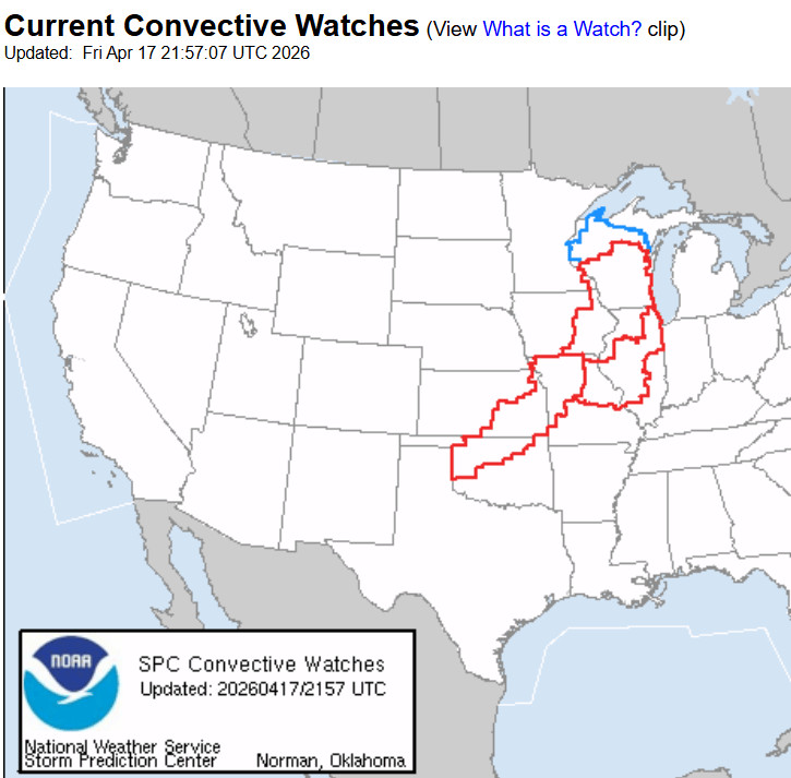
Tornado watches continue along the front from Wisconsin all the way to Oklahoma Friday evening!
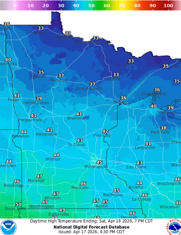
Chilly weekend ahead
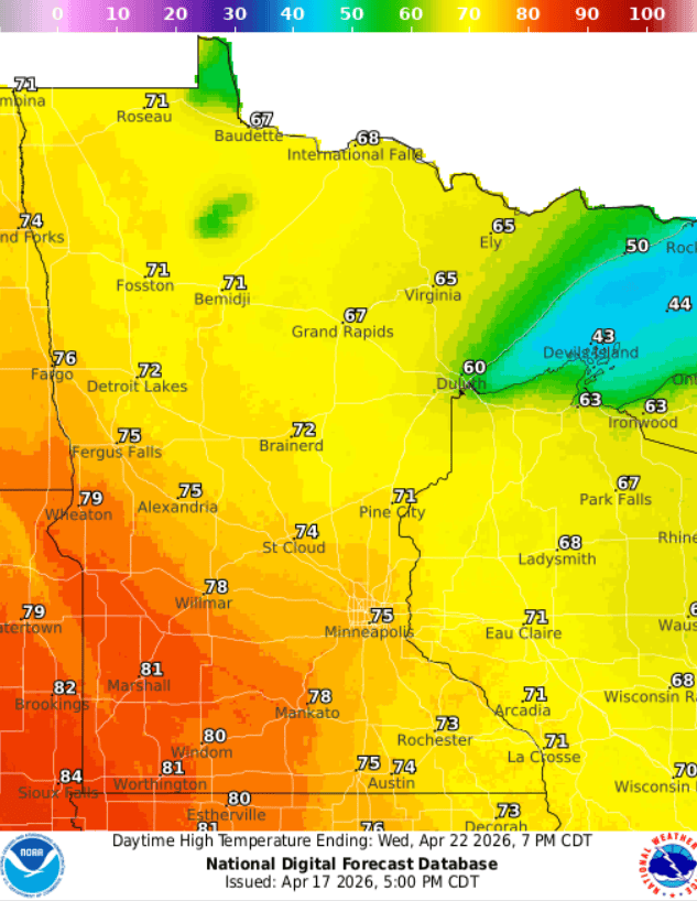
The temperature contrast behind this strong front was abrupt. Saturday brings blustery winds and much colder temperatures with 40s south and 30s north. Sunday will be mellow with lighter winds and more sun, but it will still feel more like March.
We warm up quickly next week with 70s pushing north once again.