

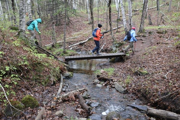
“I’m having so much fun!” exclaimed Celeste Moore on a recent May morning as she hiked a section of the Superior Hiking Trail that winds through a lush forest and over rushing creeks that tumble down the steep hillside in western Duluth near Spirit Mountain.
She had driven north from the Twin Cities with her mom, Cynthia Martinson, for a guided hike on the trail with a naturalist.
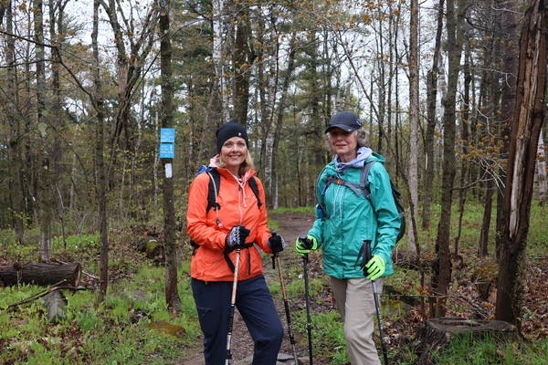
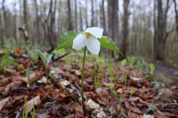
Martinson marveled at spring ephemeral flowers, bright white trilliums and anemones that blanketed the forest floor. For a few short weeks, they were taking advantage of the lack of forest canopy to soak up the sun.
"This is such an accomplishment,” Martinson said of the trail. The 83-year-old is an avid hiker who has walked a stretch of the Appalachian Trail and several parts of the Superior.
“It's Minnesota, it's home. It's wonderful, and we're so lucky to have this."
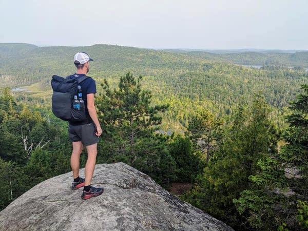
The rugged trail spans more than 300 miles atop the steep ridgeline along Lake Superior's North Shore, from an overlook north of Hovland, Minn., near the Canadian border, through Duluth to the far southern terminus near Jay Cooke State Park at the Wisconsin border, where it meets the North Country Trail.
Thousands of hikers flock to the Superior Hiking Trail every year, totaling about 400,000 user visits from May through October.
About three quarters of those hikers are day users. But the trail was first conceived as a long through-hiking trail. There are nearly 100 primitive, backcountry campsites along the route.
The idea for the trail was first floated in the 1970s in outdoor recreation plans from the U.S. Forest Service and Minnesota Department of Natural Resources. The thinking was, “How can we have our own mini-Appalachian Trail right here?" said Lisa Luokkala, Executive Director of the Two Harbors-based Superior Hiking Trail Association.
“Backpacking was a thing that was trending in outdoor recreation,” Luokkala said. “People were going out on these bigger expeditions” on the Appalachian, Pacific Crest and other major trails.
But the trail didn't get off the ground until 1986, when Lee Schar, a Superior National Forest ranger, wrote a feasibility study for the trail that became its guiding framework. That same year, business and resort owners and other North Shore residents joined with county, state and federal land managers to form the Superior Hiking Trail Association to oversee its development.
Trail construction began in earnest the following year when the Legislative Commission on Minnesota Resources kicked in nearly $400,000.
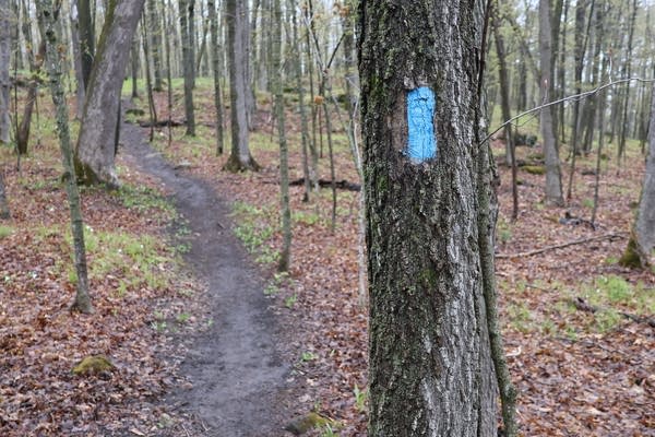
By 1989, 100 miles of the trail were complete, marked with blue blazes on trees along the path. Minnesota and Youth Conservation Corps members constructed many of those early trail miles. Laid-off workers from the taconite plant in Silver Bay were also hired.
"They were just great,” recalled Tricia Ryan, the trail association's first paid director, hired in 1991. “They were a bunch of hard-working Finnish guys who had fun and were very, very skilled at their jobs."
A Minnesota DNR staffer named Tom Peterson laid out much of the trail route, “way back before Google Maps,” said Ryan. He used topographic maps, a compass and pencil to locate prime overlooks along the contour lines.
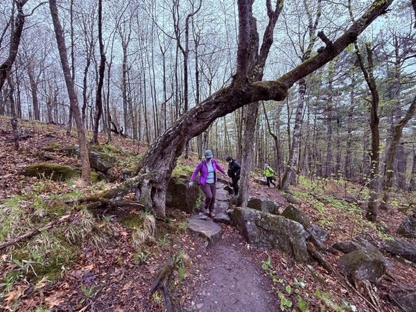
Then he'd bushwhack through the woods, tying pink ribbons on trees to mark where the trail should be built, linking those spots together. The result is a sometimes rough footpath that climbs up and down steep slopes, connecting scenic vistas of Lake Superior with stunning waterfalls.
"Tom Peterson would come to every board meeting and say the same thing at every single one of them. He'd say, 'That trail section we built last week is the best one yet,'" recalled Rudi Hargesheimer, an early trail association board member who's written two books on the trail.
Hargesheimer would then take the next day off to hike it.
"So my claim to fame — If it's true or not, I don't know — is that I'm the first person to hike 90 percent of the Superior Hiking Trail."
More than 40 miles of trail were added through Duluth’s urban wilderness in the early 2000s. The last section of trail that ends at the Wisconsin border was completed 10 years ago.
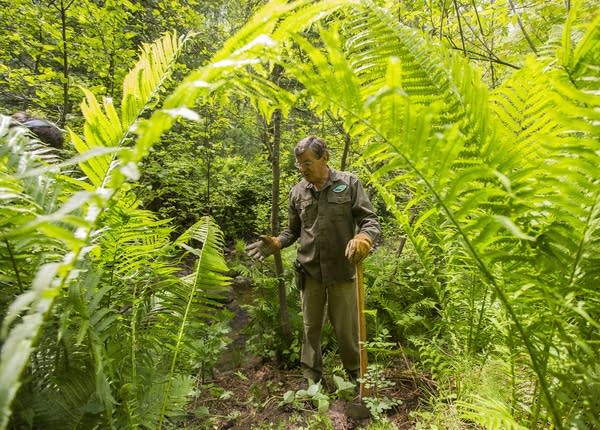
But work on a trail like this one is never done, said Luokkala. There's a lot of ongoing maintenance, almost all of which is completed by a small army of 600 volunteers. Last year alone, they donated about 10,000 hours of work.
"If you reflect back on 40 years, thinking of the collective impact and investment of our community in this trail, it's just an astronomical investment and really, truly a gift back to our community,” said Loukkala.
There are other challenges, including maintaining what Luokkala calls the trail’s "Instagram-famous locations" — most notably the trail to the overlook of Bean and Bear lakes above Silver Bay.

Two years ago, crews repaired damage to the trail from severe erosion and years of heavy use.
The trail association is also constantly seeking to protect the scenic beauty that surrounds the trail as the North Shore becomes more and more popular, as well as the current alignment of the trail, which travels across terrain owned by many different private landowners.
"We have some sections as we get further north where we have large sections of trail, that if we were to lose one parcel, one land owner” the cascading effect could affect miles and miles of the trail, explained Luokkala. “It could be pretty crippling.”
To celebrate 40 years of the Superior Hiking Trail on June 6, National Trails Day, organizers are asking hikers to sign up to hike a section of the trail. The goal is to have hikers trod every inch of the more than 300 mile trail.
Birthday parties are scheduled from 4 to 7 p.m. at Voyageur Brewing Company in Grand Marais, Bluefin Bay Resort in Tofte, Castle Danger Brewery in Two Harbors, and Ursa Minor Brewing in Duluth.